Getting here
About 120 km east of Quesnel — the last 27 km on a wide, well-graded dirt road.
The drive
Quesnel → Wells → Bowron Lake
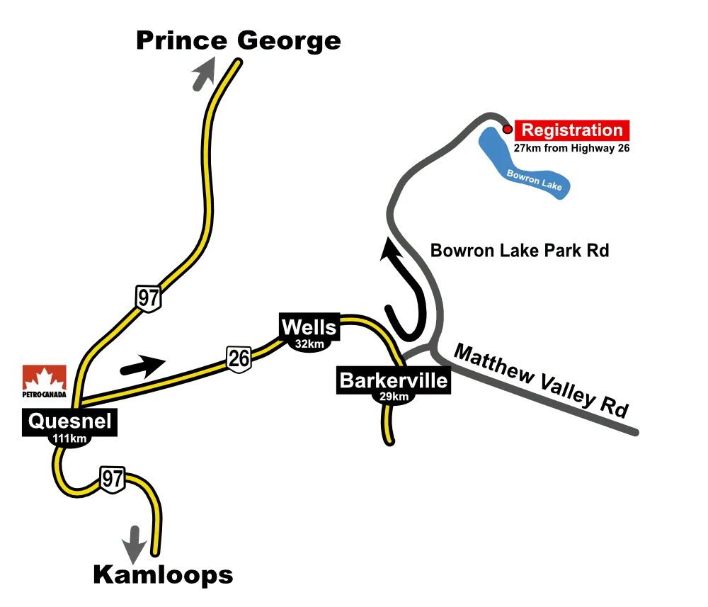
Bowron Lake Park is located about 120 kilometers east of Quesnel. Drive north on Highway 97 through Quesnel, then follow signs onto Highway 26, which leads through Wells. Approximately 1km before the historic townsite of Barkerville, turn left onto the Bowron Lake Road. From there it’s another 27 km to the park entrance on a wide, well-graded dirt road where a 25 unit front country campground and the 116 km wilderness canoe circuit are located.
Quesnel is the last major town before Bowron Lake Circuit. If you need fuel, groceries or supplies, this is the town to get them.
- HWY 97 NNorth through Quesnel — last major town for fuel, groceries and supplies.
- HWY 26 EFollow signs through Wells toward historic Barkerville.
- BOWRON LAKE RD · 27 KMTurn left 1 km before Barkerville. Wide, well-graded dirt road to the park entrance, 25-unit campground and the 116 km circuit.